Cycling as an integral part of planning
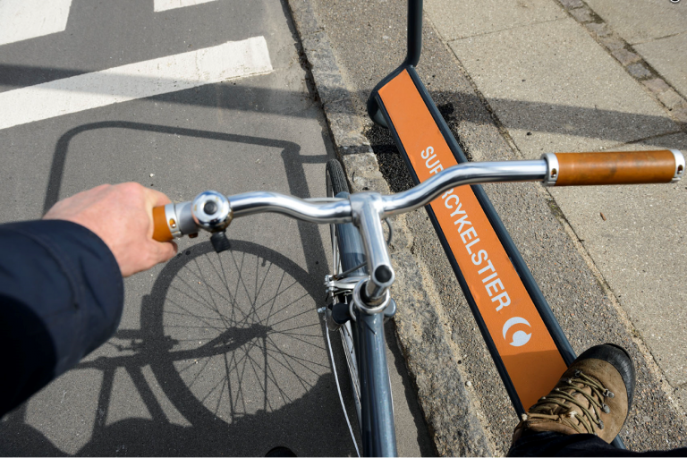
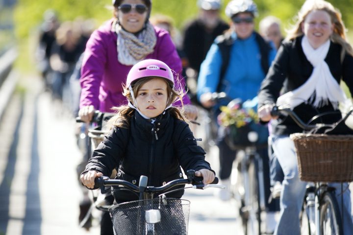 Bicycle planning should make it easy and attractive to cycle regardless of age. Photo: Danish Cyclists’ Federation/ Mikkel Overgaard
 In the local authorities’ planning departments, planners design the physical structure of our cities and local communities basing their work on different plans. It is crucial that bicycle planning should be factored in on all levels so as to ensure cohesiveness in the cycle track network and to integrate good cycling conditions into other planning. In time this will enable us to create cities and local communities that are physically designed to support and promote bicycle traffic, which is the ultimate aim.
By Maya Sig Vestergaard and Trine Bunton, Rambøll
Why should bicycle planning be an integral part of physical planning on all levels?
Example of the hierarchy in the roads and paths network
| Classification | Road network | Paths network |
| 1. Highest level of maintenance and winter maintenance | Primary traffic route | Cycle superhighways |
| 2. High level of maintenance and winter maintenance | Secondary traffic route | Primary cycle tracks and school routes |
| 3. Medium level maintenance and winter maintenance | Primary local roads | Local cycle tracks |
| 4. Lowest level of maintenance and winter maintenance | Secondary local roads | Recreational paths |
Planners in the local authority’s planning department work on plans for the local authority’s physical layout. This is done on different levels ranging from the overall level of planning strategy down to the extremely concrete and detailed local planning level. The structure of the planning hierarchy and the terminology of the individual plans vary from authority to authority.
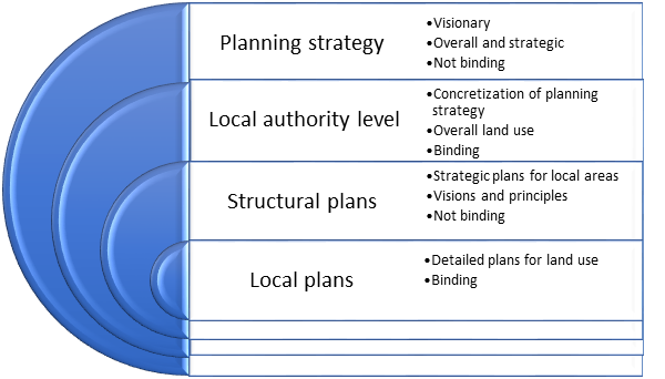
- Example of a planning hierarchy
Many local authorities also work with sector plans, which should be reflected in the physical plans. A bicycle action plan is an example of a sector plan, and it is crucial to incorporate its results into land use plans. If this fails, there is the risk that plans for the local area will directly counteract ideas for an overall, cohesive cycle track network.
Working with a cycle track network hierarchy on the same footing as a road hierarchy is helpful in bicycle planning. (See the table for an example of how such a hierarchy can be built up.) In addition the local authority should define standards for different types of cycle tracks, which should be reflected in the different local plans and use the same terminology as the municipal plan and the structural plans. This ensures a uniform understanding of standards across local fields, for example a uniform surface on school cycle routes. See more about this below in the section “Good Conditions for Cyclists in Local Planning”.
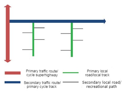
- Principles for designing road and paths networks in relation to hierarchical level. Rambøll
Bicycle planning on the overall level
There are many advantages to planning bicycle traffic on the overall level. If bicycles and cars are on an equal footing in municipal planning, and there are overall plans for creating roads and paths networks, a cohesive network of transport corridors can be established, regardless of whether the transport is by bike or by car. This helps ensure that bicycles are factored in on the same footing as other transport modes.
It is important to cyclists that cycle tracks are cohesive and are not interrupted by deviations and circuitous routes. The cycle tracks should be direct and easy to use on the trip to the city’s major destinations, and the service level should be in accordance with the track’s classification.
On the local authority level the primary cycle tracks can be clearly shown to ensure an overall connection between the tracks and to clarify the cycle track network’s structure. The secondary tracks can be linked to the primary tracks which continue on to some of the city’s major destinations such as traffic hubs, shopping centers, and workplaces.
For a number of years the capital region of Denmark and the 23 local authorities have worked on the cycle superhighways across municipal boundaries to achieve a cohesive cycle superhighway network throughout the entire region. This means that commuters can use high class cycle tracks on their trip to and from work, and can expect a uniformly high service level and excellent accessibility. The bicycle is thus a competitive alternative to the car. This also applies to transport time since greater Copenhagen is notoriously congested. For further information see the Cycle superhighways’ website.
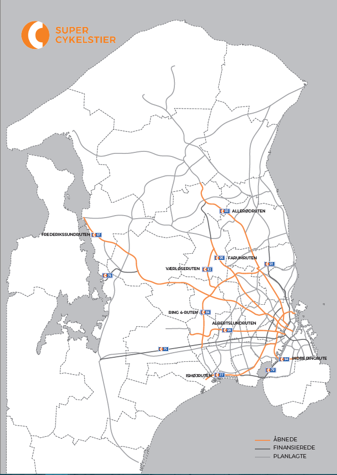
- Map of the cycle superhighways in the capital region of Denmark. Orange: Open. Dark grey: Funded. Light grey: Planned. Source: Cycle superhighways Secretariat
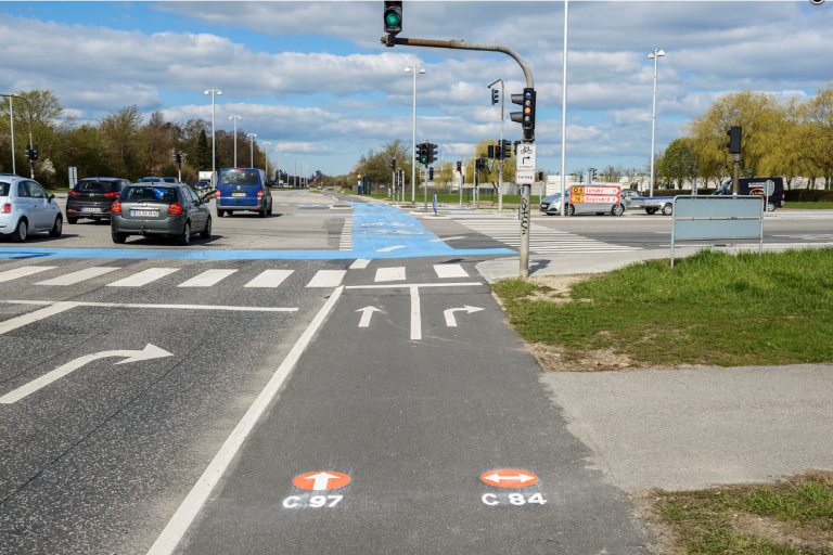
The cycle superhighways have their own identity in the capital region of Denmark, an orange “C” burned into the asphalt with thermoplastic, so cyclists can always see they’re on a cycle superhighway. This is an excellent idea since it helps cyclists understand the nature of the cycle track and supports wayfinding. For example, if you know you have to follow the Farum route to reach your destination, it’s nice to know you’re on the right track without continuously consulting a map.
Clear identification of the primary tracks makes cyclists aware of the extent of the primary cycle track network. Often cyclists have no idea which tracks are considered primary, and what service level to expect. The visual identity of the primary cycle track network is crucial for track branding.
Clear identification of the cycle track network is a good idea, as shown here in the capital region of Denmark where the cycle superhighways are marked with an orange “C”. Source: Cycle superhighways, capital region of Denmark.
What motivates choice of transport mode?
- Population density: the denser the population, the more people use a bicycle, take the bus, or walk.
- City size: More people choose to cycle in larger cities where congestion makes cycling an attractive alternative to driving.
- City shape: The distance between destinations is much greater in linear cities than in a city with a circular design, which means that there will be more cyclists in circular cities.
- Topography: In cities with many hills such as Vejle many people choose not to cycle since biking uphill is too strenuous.
- Organization of workplaces and shopping areas: Integrated transport and land use planning makes it possible to significantly increase the bicycle share. Density and obstacles to motor traffic placed in the city center or near central traffic hubs, and good accessibility for cyclists make it possible to shift traffic from cars to cycling and collective traffic.
- Traffic safety: City traffic safety doesn’t seem to affect the decision to cycle. However, it appears that the greater the number of cyclists, the fewer the accidents involving cyclists. So statistically, the more cyclists there are, the fewer the cycling accidents.
For further information about the effect of city size on bicycle traffic see: http://www.trafikdage.dk/td/papers/papers99/papers/paper/bpot/underlie/underlie.pdf
Good land use planning includes bicycle planning from the start
The local authority’s various plans for the physical design of our cities and local areas are crucial for the function of our cities and local communities, including how we get from place to place. Successful land use planning makes it easy and natural to move by bicycle or on foot.
Research shows that more people choose to cycle if the city: has more than 10,000 inhabitants; is densely populated; has a circular design; is without hills; and when workplaces are located in the city center. In other words many conditions that are difficult to change are a significant motivating factor for choosing cycling as everyday transport. Nevertheless, there are many ways to promote cycling on the level beneath local authority planning.
On this level many local authorities work with structure plans, also called master plans. Here the focus is on the local area and how different local planning fields should work together in order to create good land use and a cohesive infrastructure, including the cycle track network.
Traversing the local area should be easy, and there should be a focus on destinations such as central areas and schools. An important focus area is the link to the primary cycle track network, in order to reach more outlying destinations such as traffic hubs and commercial areas with many workplaces.
Generally speaking Danish cities cover a much greater area than Dutch cities. A case in point is Odense, Denmark vs. Groningen, Holland. Groningen has the same population as Odense, but covers one third of the space, and consequently bicycle traffic is significantly greater in Groningen. Compact cities have more cyclists.
Placement and design of central areas
Car transport can be reduced when many functions, such as shopping, leisure activities, schools, day- care centers, and traffic hubs are located in a central area, the heart of the local community, since it’s possible to park in one place and walk between the different destinations. It is crucial that the design of the central area accommodates pedestrians and cyclists as well as users of collective traffic. A well designed central area can be a meeting place in the local area where people can experience a local center, and an urban environment can arise.
However, there is a fine balance here since many functions in a small area may also mean traffic chaos if the area isn’t geared to traffic or if the design isn’t optimal. This in turn will have a negative impact on the number of people who wish to cycle or walk in the area. There will also be a need for many parking spaces since people will drive into the center to do their heavy shopping, or to pick up children from school or day-care.
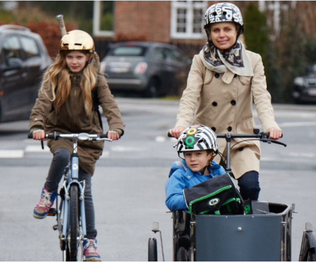
- New types of bicycle make it easier to drop off children by bike and there’s space for your groceries on the cargo bike. For some people an electric bicycle may mean they can do without a second car. Photo: Danish Road Safety Council
Der skal udvises stor omtanke ved indretningen af et centerområde og måske endda bevidst at adskille visse funktioner af trafikale årsager. Det kan fx være en daginstitution og en skole, hvor daginstitutionen oftest vil generere en del biltrafik om morgenen og eftermiddagen. Dette vil kunne betyde, at flere forældre til skoleeleverne vil være utrygge ved at lade deres børn transportere sig til skole selv. Det kræver derfor en god indretning og trafikal fordeling af området omkring daginstitutioner og skoler.
Good conditions for cyclists in local planning
Occasionally structure planning goes all the way down to the detail level, but usually detail planning is done on the local planning level. However, only local plans are binding planning documents that the developer and later citizens and homeowners’ associations are required to follow.
This is where the local authority in a dialogue with the developer has the opportunity of setting high standards for cyclists within the individual local planning area with regard to:
- Definition of cycle tracks:
- The role of the different cycle tracks in the local planning area should be made clear.
- It is recommended that the local authority already has an internal understanding of what characterizes the different types of cycle track and what standard is expected prior to the dialogue with the contractor. This may be spelled out in the local authority plan or the structure plan. It ensures uniformity in different types of residential areas, and the local authority can be clearer about cycle track requirements in the dialogue with the contractor.
- Measurements of cycle track stretch and surface:
- Good cycling conditions can be ensured, for example, by a cycle track stretch of 5 meters and a surface area of 3 meters.
- Surface:
- It’s important that tracks are established with an easily ridable surface such as paving slabs or asphalt, which is easy to maintain and salt during the winter.
- Gravel, rock dust and the like should only be used on recreational paths and not where there is a downhill incline since gravel and rock dust are washed away when it rains.
- Cycle track intersections:
- When cycle tracks intersect roads, care must be taken to ensure the crossing can take place safely.
- Within residential areas crossings can be made safe with barriers to ensure that cyclists become aware of the crossing point, reduce speed, and don’t ride directly onto the road.
- When cycle tracks cross primary roads: Traffic islands are a good idea when cyclists need to cross a road with a certain amount of traffic. Traffic islands make it possible to cross the road in two phases. Establishing a bicycle tunnel is also worth consideration so as to ensure cohesion with the primary cycle track network or create a safe school route at the given location. This may have relation to the track’s classification. The local authority can enter into an expansion agreement with the contractor.
- Expansion agreements:
- It may be relevant to enter into an expansion agreement with the contractor (cf. the Danish Planning Act) if the local authority finds that an infrastructure construction is necessary as a consequence of the urban development made possible by the local plan, for example a bicycle tunnel or a traffic light, and the authority doesn’t have funds for the construction at the present time. In that case the contractor can enter into a voluntary expansion agreement regarding full or partial funding of the infrastructure construction in order to hasten the urban development project.
- Lighting:
- It must be decided whether or not there should be lighting on the tracks. This may be related to the track’s classification.
- Bear in mind that there are security issues with bollard lighting. Bollard lighting lights downwards and the cyclist’s face is not illuminated. Meeting someone on the track in the dark may feel insecure. In addition, bollard lighting is often vandalized.
Transport cycle tracks on the local planning level (i.e. non-recreational tracks) should follow the principles for primary tracks when it comes to routing, which means the route to the destination should be relatively direct. School children, for example, quickly figure out the fastest route to get to school before the bell rings, and if traffic islands and bicycle tunnels aren’t placed on this route they will not be used.
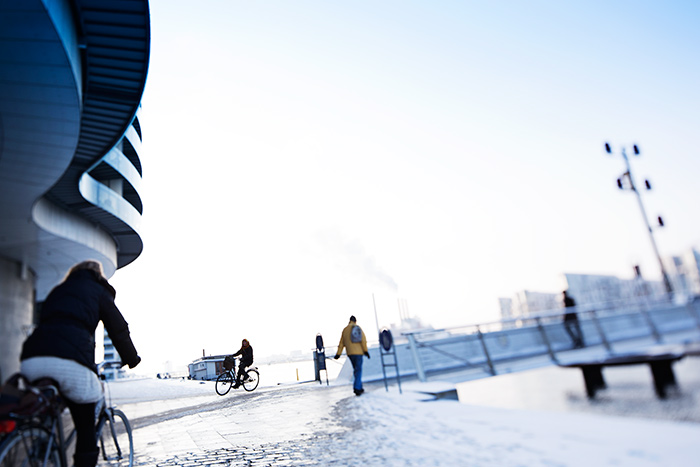
Winter maintenance of the primary cycle tracks is important. Photos: Danish Cyclists’ Federation
Promoting cycling through a mobility plan
It is essential to integrate cycling into all traffic planning that aims at combining different transport modes. A mobility plan makes this possible, and it is also essential to integrate a mobility plan into all physical planning.
What is mobility?
Mobility is the expression of our need to reach our various, daily activities. Traffic is a product of our need for mobility. Mobility planning is planning whereby regional administrations or local authorities formulate visions and objectives for the type of mobility desired and concrete measures to achieve them.
Mobility planning makes holistic planning possible, which can affect transport habits in the long run. Changing the population’s mobility demands and transport habits is an effective way of optimizing existing investments and capacity.
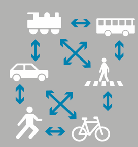
- Principle of strategic mobility where mobility is seen as a whole made up of various transport forms.
In a mobility context people are not seen as solely drivers, cyclists or users of collective traffic. They are human beings who need to move from one place to another. How they do this depends on what makes most sense to them in a given context.
People in the transport system can be considered mobilists.
In this context, cycling is an extremely flexible transport mode, which makes it easy to combine it with other transport modes. Consequently, it is fundamental to include cycling infrastructure in mobility planning.
Choice of transport mode depends on several factors and varies from individual to individual and situation to situation:
- Time – how long does the trip take?
- Reliability – can I be sure I’ll get there on time?
- Flexibility – how many departures are there?
- Comfort – is the type of travel comfortable? Can I bring children or baggage?
- Security/traffic safety – do I feel secure on this type of travel?
- Number of transfers – Many transfers may be perceived as a greater inconvenience than longer travel time.
- Finances – what can I afford/ what is high up on my list of priorities?
- Options – is a driver’s license or a car available? What about cycling?
- Destinations – how close to the destination can I get with the given transport mode/combination of transport modes?
- Health – are there any health benefits, for example from cycling?
- Environment – which transport modes are best for the environment?
If it’s not possible to cycle the whole way, it should be attractive to cycle on part of the trip. The mobility plan should help ensure good bicycle parking facilities at traffic hubs when transferring to another transport mode.
The concrete solution is specific to the location and very few solutions are applicable everywhere. Larger cities will choose different solutions than rural local authorities, and the incentive to promote cycling will often be greater in cities where congestion is an issue.
Mobility planning can help promote cycling in other ways than by ensuring good combination options. The individual city’s parking strategy can help support bicycle traffic. When there are good parking facilities close to major destinations such as the central, commercial shopping streets, large shopping centers, concentrations of workplaces and educational institutions, there is less incentive to take the bicycle rather than the car. On the other hand if there is a distance between the parking space and the destination more people will consider the bicycle an attractive transport mode.
In larger cities where rush hour congestion is an issue the bicycle will be perceived as a good alternative to the car in relation to travel time. This can be supported by creating shortcuts for cyclists whereas drivers need to take a more circuitous route in order to reach their destination.
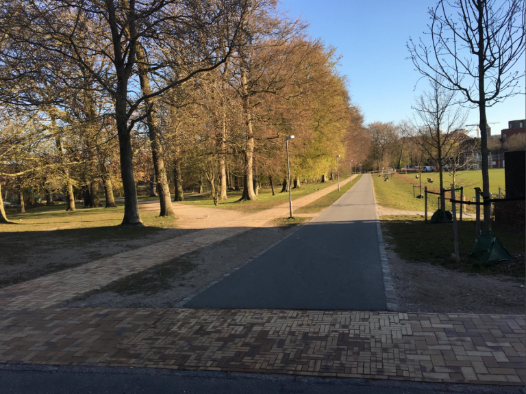
- Cycle track through Munkemose in Odense. The route is 450 m long if you walk or bike, but drivers need to drive 1000 m and cross two signal controlled intersections. Source: Troels Andersen, Odense municipality


